
1616
We had one day to play after returning to Herald Bight from Monkey Mia, before our departure to Dirk Hartog Island. Long time work colleague and family friends Barry and Glenys Kitson were holidaying at Denham and we were trying to set up a catch up over a cuppa on Singularity. Whilst in Monkey Mia I had been texting back and forth, and sent Baz a picture of the Monkey Mia communications tower, as that is what gets Barry’s blood pumping :)
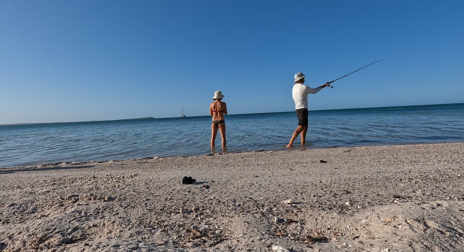
With our impending departure to Dirk Hartog, the only course of action was for Barry and Glenys to drive across to Herald Bluff from Denham for a catch up - about a 40 minute trip. Unfortunately the weather gods were not co-operating. With a 25+ knot south easterly howling across the bay, combined with a low tide, the only option was a long walk across the shallows to Bob and then a wet ride out to Singularity. Even a freshly baked loaf of Nicky’s banana bread couldn’t entice them! So a catch up on the beach instead, a transfer of bread and frozen berries, and the next catch up planned for when we return to Perth. Pete waved farewell and returned to Singularity, watching Baz depart down the beach in his trusty Amarok.
We decided to go and explore the headland and beach to our west and with the south easterly abating somewhat Pete was also keen to get the kite out for a blast. We piled the gear into Bob and headed over to a nice secluded beach and whilst Pete pumped the kite, Nic set up the umbrella and pulled out her latest book. The wind faded pretty quickly - meaning a short session for Pete, but combined with a nice beach walk, it was all good.


We returned to the boat and discovered a couple of texts on Pete’s phone - Baz had managed to bog the Amarok on the way off the beach and had spent the best part of a couple of hours extracting himself with the help of another 4WD! Of course we had been none the wiser or we would have been over there with the shovel!! Anyway, they made it back to civilisation…’all part of the adventure’ quipped Nicky.
Early the next morning, just before sunrise, we were up and prepping Singularity for the passage across to Dirk Hartog Island. Prep means making sure everything is stowed away, windows and latches closed, safety straps across the transoms, unzipping the mainsail sail bag and turning on all the electronics and marine radio. Engines on to warm up and we raise the mainsail whilst still at anchor - the boat is naturally facing into wind, so much easier than trying to hold her into the wind once underway. Then it is up anchor - Nicky on the foredeck with the anchor control in hand giving hand signal directions as to where the chain is laying. There is quite a bit of weed here, so it is slow going as Nic tries to remove it from the chain as it comes aboard - if it goes into the anchor locker then it just gets smelly!
A south easterly wind of about 12 knots is blowing so we quickly turn the engines off and unfurl the screecher as we track north up Cape Peron. The early morning sun provides amazing colours on the red cliffs as we pass them by, all the while watching patiently for our moment to furl the screecher, turn around the Cape and head south west back down the western side. Like many places north, Cape Peron has some interesting tide movements and as we are tracking west across the tip of the Cape there is almost a small standing wave where the tide is running against the wind. Quite a sight with whitecaps and small rollers that abruptly stop and turn into a glassy sea where the tideline ends. Very cool to see and makes us imagine what the Kimberley will be like where the tides are 4 or 5 times bigger.

We are heading back to Dirk Hartog Island, famously landed on in 1616 at Inscription Point by Dirk Hartog, and subsequently visited by notable explorers Willem de Vlamingh and William Dampier. All of their landing points were at the north end of the island, primarily because they didn’t pass through Steep Point like the modern sailor. Our destination of Quoin Bluff South, however, is located about 27nm from the northern end and about 30nm south west of Cape Peron. We’ll have to wait until next season to check out this famous piece of real-estate.
After a cruisy passage, with quite a few navigation changes to avoid the shallow sandy weed banks that frequent Shark Bay, we make our approach into Quoin Bluff South. We pass quite a few trawlers at anchor - all working the prawn fishery which involves working during the night then anchoring up and sleeping during the day. There are about 18 trawlers working the Shark Bay fishery which extends north to about abeam Cape Cuvier and then down into the eastern entrance to Steep Point. On our journey north, our prevailing winds were westerly and northerly, now our prevailing wind is southerly so we head to the north side of Quoin Bluff South. As we approach, there are dugongs popping up all around us - they never seem too bothered or interested in us so we continue on and tuck in nice and close to the shoreline in order to gain protection from the wind.
The wind has dropped, the sun is out and one of the most interesting things about Dirk Hartog is that it is quiet…. SO quiet. At Ningaloo you have the surf crashing on the outer reef, none of that here - just quiet. Time for a quick swim and a bit of lunch before we head into the beach for a walk and explore. When we visited in May the wind was quite onshore on this side - so much so that there were small waves breaking - so to see it crystal clear and sunny is very special.
Like all of our travels we try and read up as much as possible on the local history etc and whilst at anchor here Pete comes across a book titled ‘A Small Boat Cruising Guide to Shark Bay’. We are able to order a copy online and opt for the digital copy as well so we can download it and read straight away. The only problem being that the internet has become a bit hit and miss - but we finally make it happen.
To quote the text of our new book ‘In October 1859, a small force of 15 soldiers under the command of Lieutenant L R Elliot arrived in the schooner Pelsart and established a base on the bluff which operated until May of 1851. The purpose was to protect nearby guano deposits from exploitation’. They built a small stone jetty, which is still visible right in front of where we are anchored, as well as a number of stone huts and two cannons placed on the top of the Bluff. We were able to locate the remains of one of the stone huts and there is a rock cairn on top of the bluff which indicates where the cannon were placed. The view from the top is pretty spectacular and so a perfect strategic location - to protect the bird shit - lol!


The wildlife here is incredible - sea eagles, ospreys, pelicans, dugongs, sharks, shovel nose rays, sting rays…. just to name a few of the creatures we spotted whilst walking the headland of the bluff. The ospreys here are amazing - to watch them from the water as they sit just off the bluff, using the updraft to hold them in position, without a single wing movement, is something to behold. The view from the high vantage point lets you see all of what is swimming around, and with them oblivious to you, there was an endless procession of big rays and a big shovel nose ray - we estimated to be about six feet long - just cruising the shallows and swimming amongst the fish. Very cool!
The next day was going to be light winds and sunny so we planned on a big exploration day over to some bays about 3nm north of us. Before we do that, it is walk time and we walk down the beach away from the Bluff towards Herald Bay. There is a group camping on the beach and as we walk past we meet ‘Capes’ aka Darren Capewell who is one of the local indigenous legends who runs tours around Shark Bay. We strike up a conversation and learn that on this trip he has a bunch of indigenous youth from Geraldton and other areas on a youth leadership camp - learning about bush tucker, history and generally just trying to get them out onto country. Pete is wearing his Parnpajinya Hawks cap (Western Desert mob), which is picked up on and we have good yarn.
Back to the boat, load up Bob with diving, fishing and picnic gear, and off we go. We are heading about 3nm north west and these beaches and rocky headlands abut an electrified fence that runs 12km across Dirk Hartog from east to west in order to keep the feral cats out. This is all part of the 1616 conservation plan to return the island to the same state it was in when Dirk Hartog first arrived in 1616. Between 2007 and 2018 over 10,000 goats and 5000 sheep were rounded up and removed from the island. Since 2018, 13 native species for conservation and fauna reconstruction have been introduced, with 10 of those likely to have been present in 1616. A number of the species, including the Banded Hare Wallaby, have been relocated from nearby Dorre Island, one of the last true untouched islands where there are no feral predators.
We are keen to get in the water and find a small patch of coral reef - so Pete is quick to get wet and soon returns with a nice Blackspot Tuskfish - a close cousin to the Baldchin, so great eating. There are plenty of fish around but nothing too sizey - a lot of small coral trout and some nice emperor - but they are all keeping their distance. Nic is keen to snorkel in and around a large rocky headland - which is quite shallow, but looks interesting. We head over there and discover that the headland is full of caves - some very deep and black that we are too chicken to enter and some not so deep, but full of fish. We nail a couple and then head back to the beach for some refreshment and beach time.
Soon it is time to go home, so we start heading back to Singularity. The wind is only just starting to come in - it’s about 3pm now - so we head south into Herald Bay before coming back around to where we are anchored up against the Bluff.
The next morning we move around to Notch Point, about 3nm south of the bluff. Another beautiful spot - and there are two land camping spots here (known as Tetradon Loop) which would be superb. Notch Point is the entrance to Tetradon Loop (large estuary) and was the site of a significant pearling camp between 1870 and 1900 - with both a European and Chinese camp located close to each other and operating about 50 vessels collecting pearl shell. A walk around the beach here still reveals a lot of discarded pearl shell in the sand so there must have been a mountain of shell back in the day. We explore around the bush area and up onto the ridge - which is old reef structure - quite similar to the islands of the Abrolhos. A perfect morning - glassy and an awesome view to take in. Too good for land-based activities, so we race back to take Bob for an explore.


We decide on an explore and fish, of course… hoping for some squid, but no luck.
In 1801, the explorer, Baudin, named Tetradon Loop due to the large number of pufferfish (Tetradon species) that they encountered. Well, we can advise that in 2022 the good old Nor West blowie … also known as the Silver pufferfish or Silver Toadfish are alive and well here. A couple take an interest in our squid jigs, but they’re not the sort of fish you want to bring aboard - lots of spines, toxic to both humans and animals, and, worse still, may bite anything and everything in a feeding frenzy!! Yikes… pull those lures out!
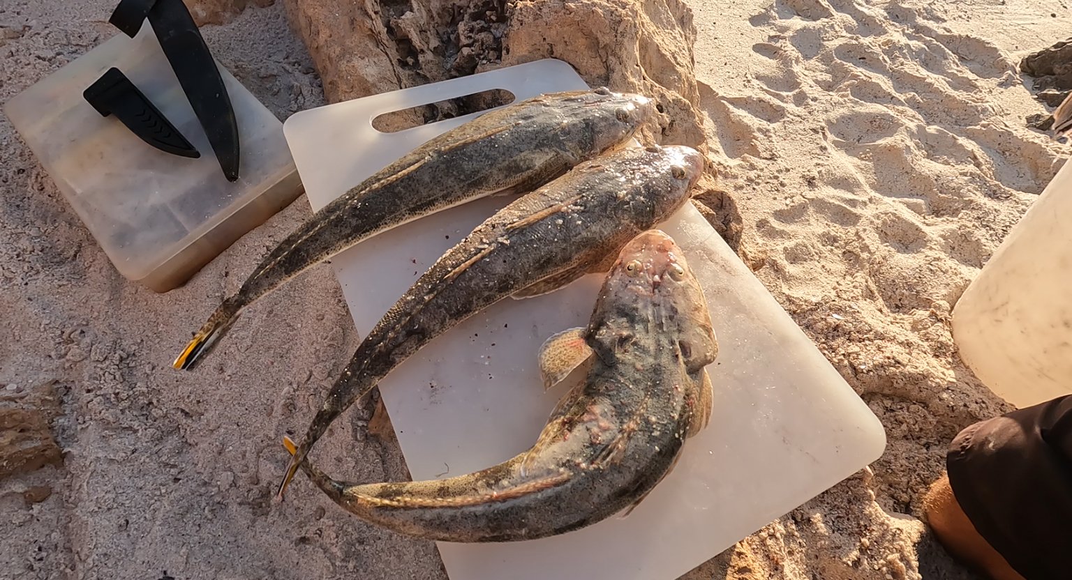
We have a fun afternoon casting lures across the shallows, catching whiting and flathead, and we keep a couple for dinner. More filleting!
With a weather window approaching for a passage south, yachts and other vessels are starting to make their way to Steep Point for an expected departure in a couple of days time. It has been nearly four weeks since the last decent weather window to cover the 180nm to Geraldton, so yachts are appearing from everywhere. At one point, using the AIS (Automatic Identification System), we are able to see that there are already 8 yachts waiting at Steep Point, and, in a day’s time, we will be joining them. But first - time to check out Dirk Hartog Island homestead.