
Back in the Bay… Shark Bay
After a great, but busy, few days in Carnarvon it was time to continue south and back into Shark Bay. With the southerly winds in a consistent pattern, we had a small window to leave and we took it to travel the 45 or so nautical miles to Herald Bight, located on the east side of Cape Peron.
It was a pre-dawn departure in order to allow us to take advantage of the east in the south wind… before it went completely south. The winds were also not expected above about 15 knots, so we were anticipating an ok passage. Departing the Carnarvon Boat Harbour and then Teggs Creek was a little nerve wracking in the pitch dark – navigating the tight channel using the flashing marker lights and trying to cross reference with the chart plotter – a bit tricky!!
Soon, we were clear of the channel and then we had to turn into wind and raise the mainsail. Sounds simple, but in the dark, into a bumpy sea and trying to keep the boat into wind without travelling too far into the shallows is always a challenge and involves good teamwork. With Pete helming and raising the mainsail by hand and Nic on the cabin roof making sure the mainsail is clear of the lazy jacks (guides to allow you to raise and drop the sail without touching / guiding it into the sail bag), it takes a couple of minutes to get it up and secure and then turn to our desired course, adjusting the traveller (controls angle of the boom) as we move away. Then, we unfurl the jib straightaway as this provides some balance as well as a few extra knots of speed.
In no time, we are watching the lights of Carnarvon disappear and the first signs of dawn over the land to the east. The kettle is on and we set ourselves on course, looking at the wind angle and how we are travelling. On this passage we have two choices of route – if it is quite east we should be able to travel east of the Peron Flats, located off Cape Peron, or, if it goes more to the south then we will pass west of the flats. The flats run for about 6nm and are home to at least one ship wreck, the Gudrun, which was only found in 1989, some 88 years after her sinking!
Of course, the south easterly fails to show its face and so we find ourselves close hauled into the southerly. In these sort of instances, we often run one engine just to keep some speed up – knowing that by late afternoon the southerly will be 25+ knots and we don’t want or need to be out in that.
Pete is trolling a lure and it gets hit by something big and, in line with our fishing luck of late, the lure disappears and a frustrated skipper pulls in the empty line… if it is not dealing with ribbon and seaweed it is gear failure!! More cursing – nothing a cup of tea won’t fix - even if it is the tenth one for the day!
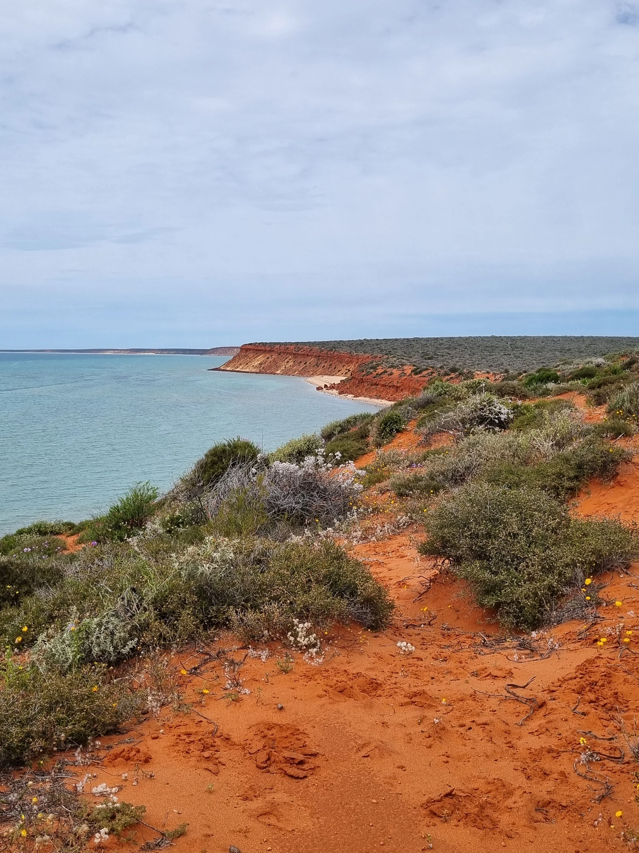
After a few hours, we sight the red cliffs of Cape Peron and soon sight the Peron Flats. According to plan, we pass just to the west of them. The wind is tapering off as we come into the lee of the Cape and we know that we will have some tidal current to deal with as we close in on the Cape, so, with a change in wind angle, we unfurl the screecher and turn off the engine.

It doesn’t last long as the wind angle becomes too tight, so back to the jib as we run down the east side of Cape Peron into Herald Bight. A new anchorage for us – but well protected from the southerly winds so we have a rough idea of where we want to anchor, but will need to work that out as we get closer to the southern shoreline. Like most of Shark Bay, the Bight consists of areas of sand and weed, with depths varying from 0 to about 8 metres. With Singularity, we can tuck in close to the shoreline where the weed banks end and it is sand bottom. It is too shallow to go right into this sand area (bearing in mind the tide differences throughout the day), so we look for a sand hole amongst the weed where we can drop our anchor and get a good bight. Anchors won’t hold on weed as the weed stops the anchor from burying into the sand and getting a good hold. You may think initially that you are ok, but once the wind gets up you will start dragging – which is no fun – especially in the dark!
Nicky is on the bow and guides us right over a small sand hole, probably 3 metres by 3 metres and we drop the anchor to the south or shoreside of it. We are in only 2 metres of water – the joys of a catamaran – but let out about 16 metres of chain which will help hold us steady. Once we have laid out the chain, Nicky attaches the bridle which is a rope from each bow joined together with a stainless steel hook that the anchor chain clips into, and we reverse the boat at about 2000 revs, creating a strong pull on the anchor. This ‘buries’ the anchor and we establish if the anchor is holding or if the anchor is dragging – something you generally work out straight away. If in doubt, we bring the anchor back in and repeat the process.


Two days later, we have some weather coming and we sit out 40knots of south west wind. Our position is super sheltered and whilst it is windy there is such limited fetch (the distance the wind has to create swell and chop) that sitting inside the boat with the sliding door shut you wouldn’t even know it is windy. Love these anchorages!!
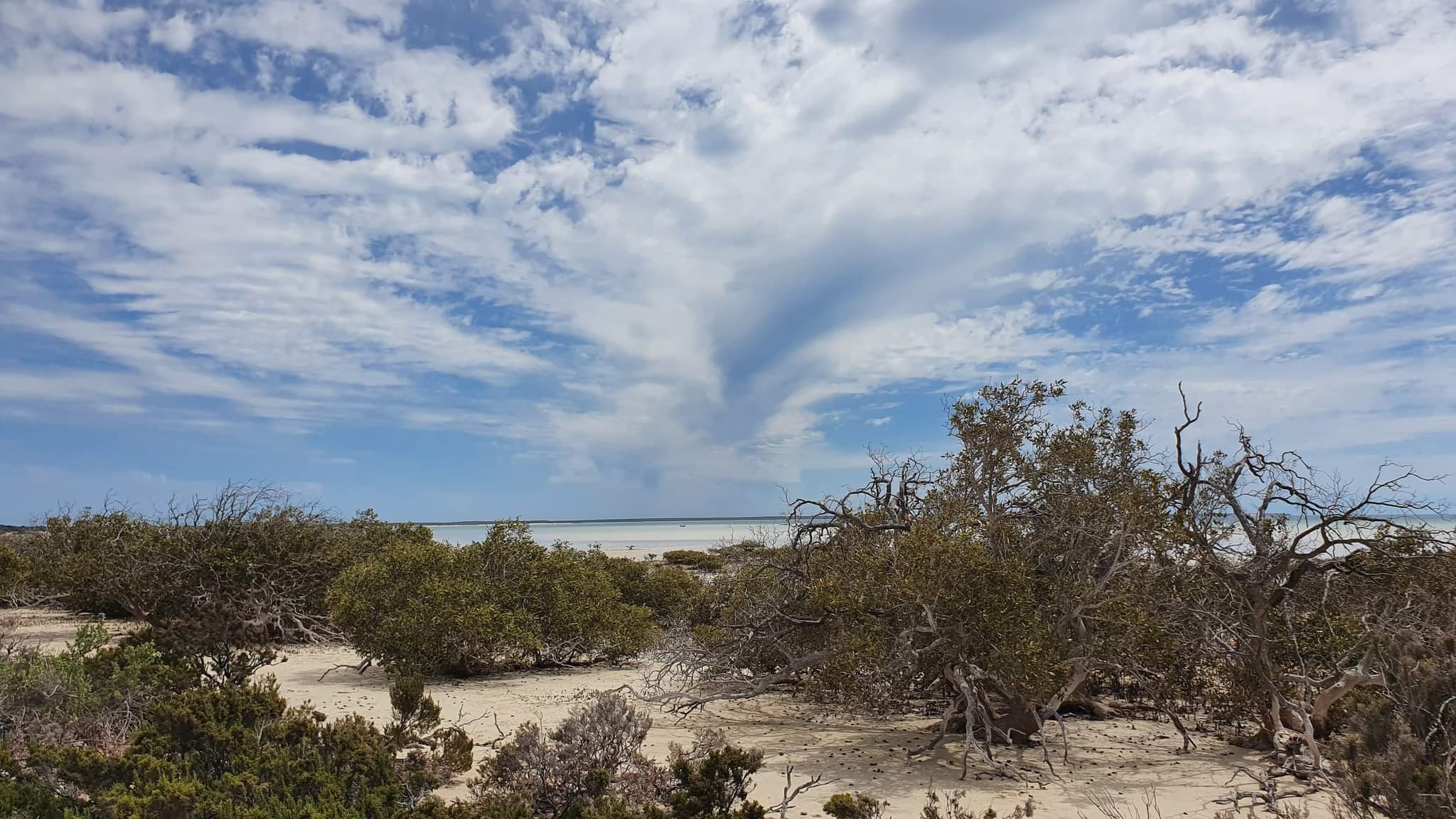
We get into our routine of exploration, fishing and generally making the most of what the Bight has to offer. About a mile to our east is Guichenault Point which has a mangrove and creek system, along with a sandbar that stretches north for about five miles. This sandbar has numerous small sand islands and flats when the tide is low and is home to an abundance of pelicans, cormorants, turtles and sting rays.
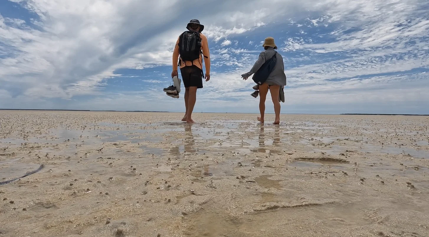
Bob gets a workout and we leave him on the beach to explore the Point on foot, cutting through the mangroves out onto the flats and around to the eastern side, checking out the low tide shellfish and crabs, including Shark Bay cockles.
After consulting Google Earth, we return the next day and walk through a creek system at low tide, up to our shins in mud at one point as we make our way westward. After popping out on the beach, we end up separated and navigate our way back through the mangroves to where we left Bob. Pete decides he will follow the water course and finds himself nearly waist deep in the mangrove system – one eye looking for any sign of mud crabs, the other eye looking for any signs of crocs! Plenty of swimmer crabs, but only one small muddie sighted.


We try our hand at fishing, but all that seems to be on offer is whiting and Nic nails one, which gets returned in sympathy!
To our east is the imposing Herald Bluff which we are keen to explore. To get access to the shore, we have to time the tides as there is a long shallow sand flat adjacent to the shoreline which runs to about 500 metres out but is only waist deep at its deepest point. We take Bob as far as we can then raise the motor another notch to make another 100 metres and then we walk, dragging Bob behind us as far as the tide allows. Carefully – watching for stingrays and shovel nose rays that frequent these flats, as well as other little hazards like razor shells that will slice straight through a wrongly placed foot. We then abandon Bob on anchor about 250 metres from the shore – knowing the tide will come in but will only be waist deep at its peak. The alternative is dragging Bob all the way across the flats – which is kind of pointless! We have kitted Bob with a good sand anchor and 5 metres of solid chain – more than necessary, but it gives us piece of mind, whether at a surf break or on these tidal flats, that he will still be there when we return.
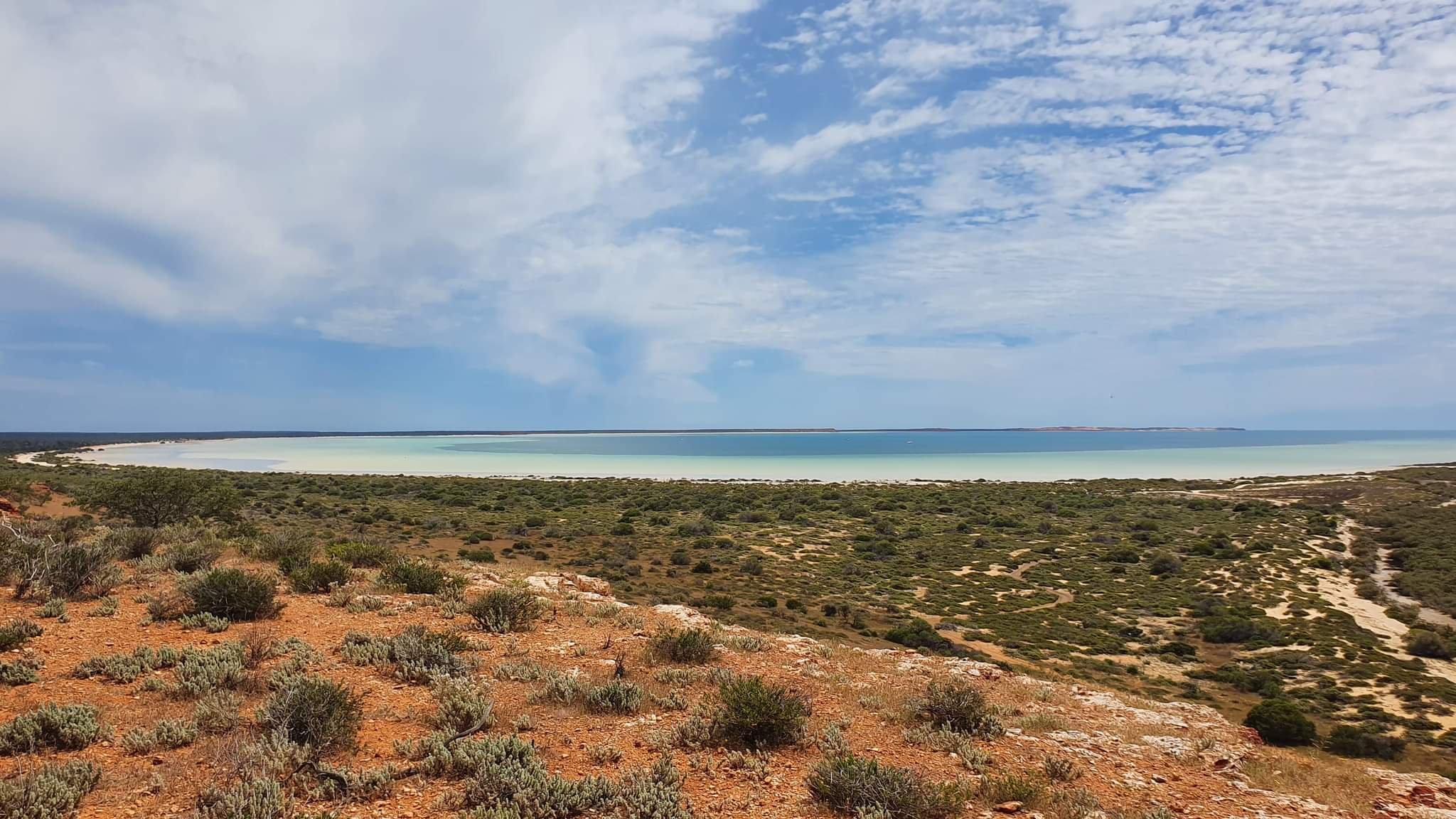
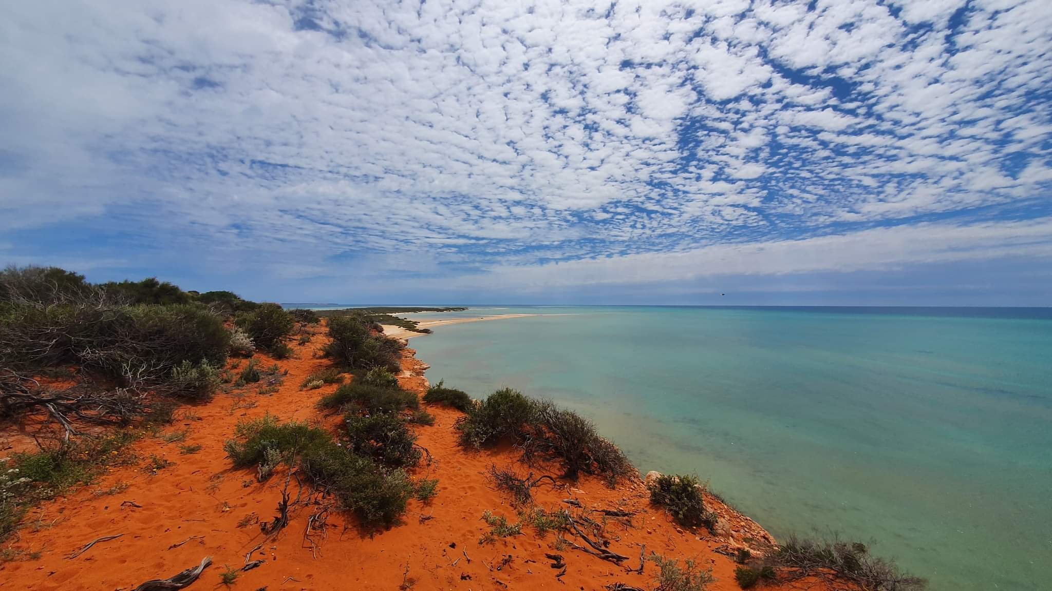
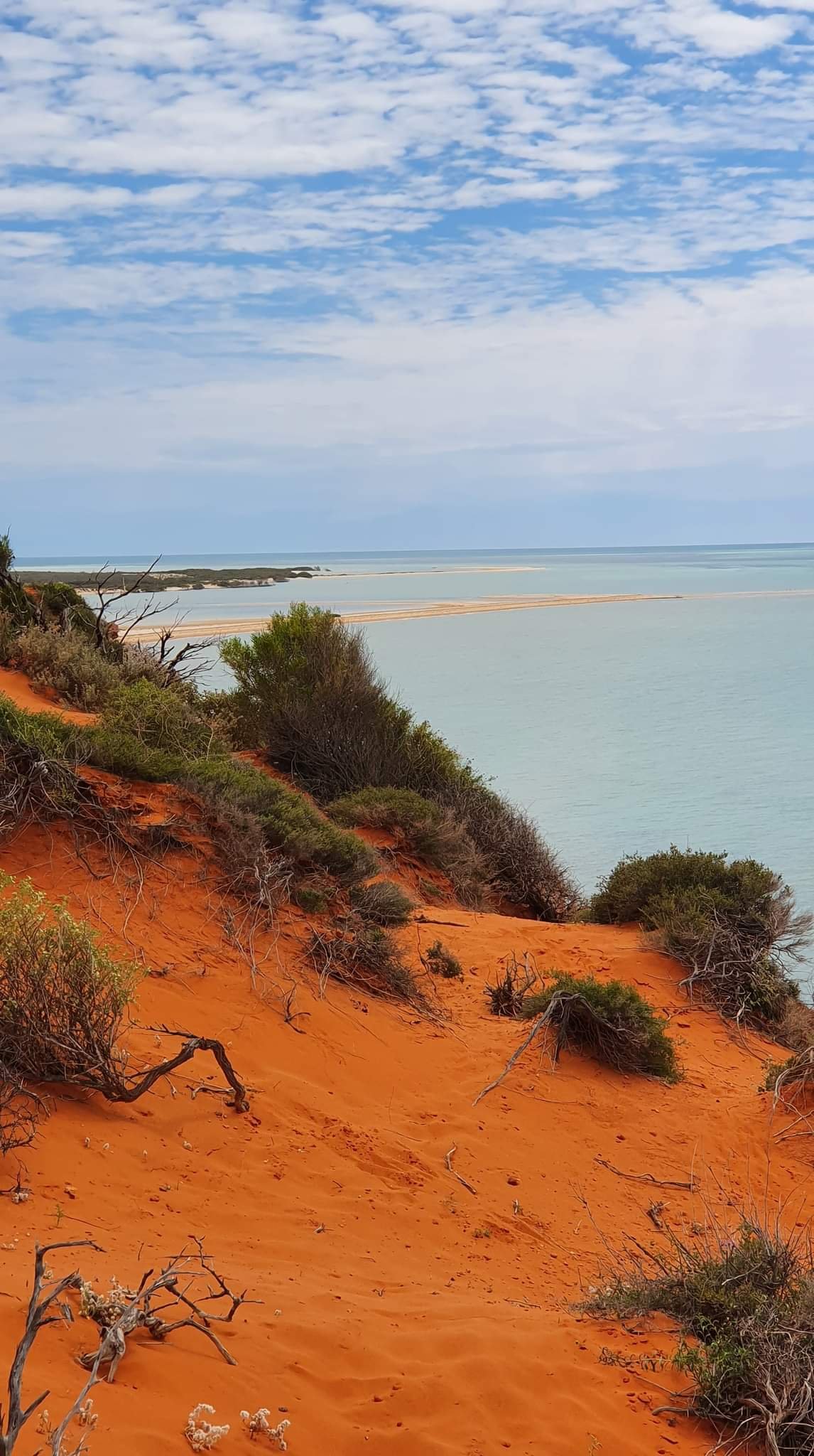
It is a couple of kilometres walk along the beach to get to the Bluff and then we follow a black sand track inland to the base, before deciding a route to make our way up. Soon, we are at the top and admiring the view back across the bight towards Cape Peron, across the mangrove system and out to the sand flats and the ocean east.
We carefully walk along the edge of the Bluff, checking out a number of sink holes and caves as well as the flora and fauna. We identify some bush tucker – ‘bush beans’ which are similar to a broad bean, but must be cooked to be eaten or sickness will result, as well as ‘bush tomatoes’ for which we can’t find a ripe one.
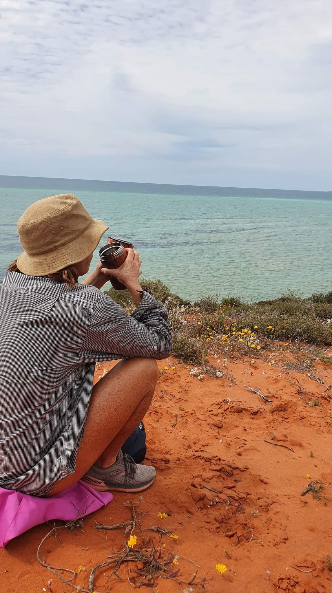
Plenty of evidence of animal activity – wallabies, we think, and we follow the animal tracks around the headland to the south east. We are greeted with a great view down the peninsula towards Cape Rose and Monkey Mia. Finding a good vantage point, we prop on a small sand dune area and have a cuppa and some fruit whilst watching the wildlife and view through the binos. We really enjoy just sitting quietly watching the world go by and appreciating how good this area is – World Heritage for a reason eh!


We enjoy our days exploring the area, but decide that with the approach of the AFL Grand final we might use that as an excuse to head over to Monkey Mia – somewhere that we both last visited in the 80’s – and see what has changed in the past thirty years!