
Abrolhos Week 1 - Pelsaert
One of the few places in WA that we hadn’t experienced before was the Abrolhos Islands, so there was excitement as well as some nervousness as we planned our visit. Every person we spoke to made some reference about ‘a lot of reef’ and ‘a lot of shallow spots’ so we were a little nervous about navigating our way around, especially as the charts don’t really give you a great indication other than a lot of shallow areas!!
We were fortunate to have Captain Ash in our corner and armed with his advice, in the form of copious notes and some photos of his plotter, we were wary but confident in our ability to negotiate the islands. The plan was to head to the Pelsaert Group first up, as we had heard great reports about the lagoon area and were keen to sample this. There was also a cold front forecast to pass through around Anzac Day, so we would take anchorage at Middle Island.
We had a fairly uneventful sail for the 30 plus nautical mile, albeit we were going dead downwind, which we are yet to really master. Hence we were trying to add some angle into our track to give us better sail performance, which really just means adding more time to your journey. Plenty of boat traffic heading over to the islands, everything from big charter boats (Abrolhos Adventures ferry 100 feet long) to small 30 foot recreational boats.


The Abrolhos Islands are a group of low lying coral atolls… and low lying they are, making them almost impossible to see until you are right upon them. The Dutch found this out the hard way of course; now the first things that you see are the fisherman’s sheds and shacks. At first, we thought it was surf breaking on the reef, but as you edge closer and gaze through the binoculars, you realise that what you are seeing are actually buildings. We turned left at Post Office Island and made our way down into the sheltered waters of the Pelsaert Group.
After consulting the WA Cruising Guide, we had decided to go straight to Middle Island, where there are two moorings and an anchorage recommended for strong westerly winds. As we made our way down the channel, we could see vessels in the distance and at this point you start to realise how low lying everything is, as these vessels were in anchorages, but appeared to be just sitting out in the middle of the lagoon. We came to get used to this as we travelled throughout the Pelsaert and Easter Groups over the next three weeks - you would see the vessel before you actually saw the island - which only reinforced our initial perceptions that the actual view versus the chart view is very different.
After negotiating into Middle Island anchorage, we quickly came to the realisation that a lot of navigating here is by eye, picking your way through the shallow maze of coral. Mental note to self - wait for the sun to be up and about before undertaking any tricky maneuvering! With a couple of days of ok weather ahead of us, we were able to quickly get in the water and break out the spear guns and cray loops. Fish and crays were on the wanted list and our first outing provided a couple of nice Baldchin Groper to get us underway. Yummo!
As referenced in our ‘Wild Ride’ blog, we had a little weather to contend with. Interestingly enough, it had only been touted as a ‘Strong Wind Warning’ forecast for 30 knots. In the weeks since, we have spoken to a number of cruisers, both on yachts and motor boats, who got a slapping during that front, with some sustaining damage. We are thankful that our interpretation of the Cruising Guide put us in a safe spot.
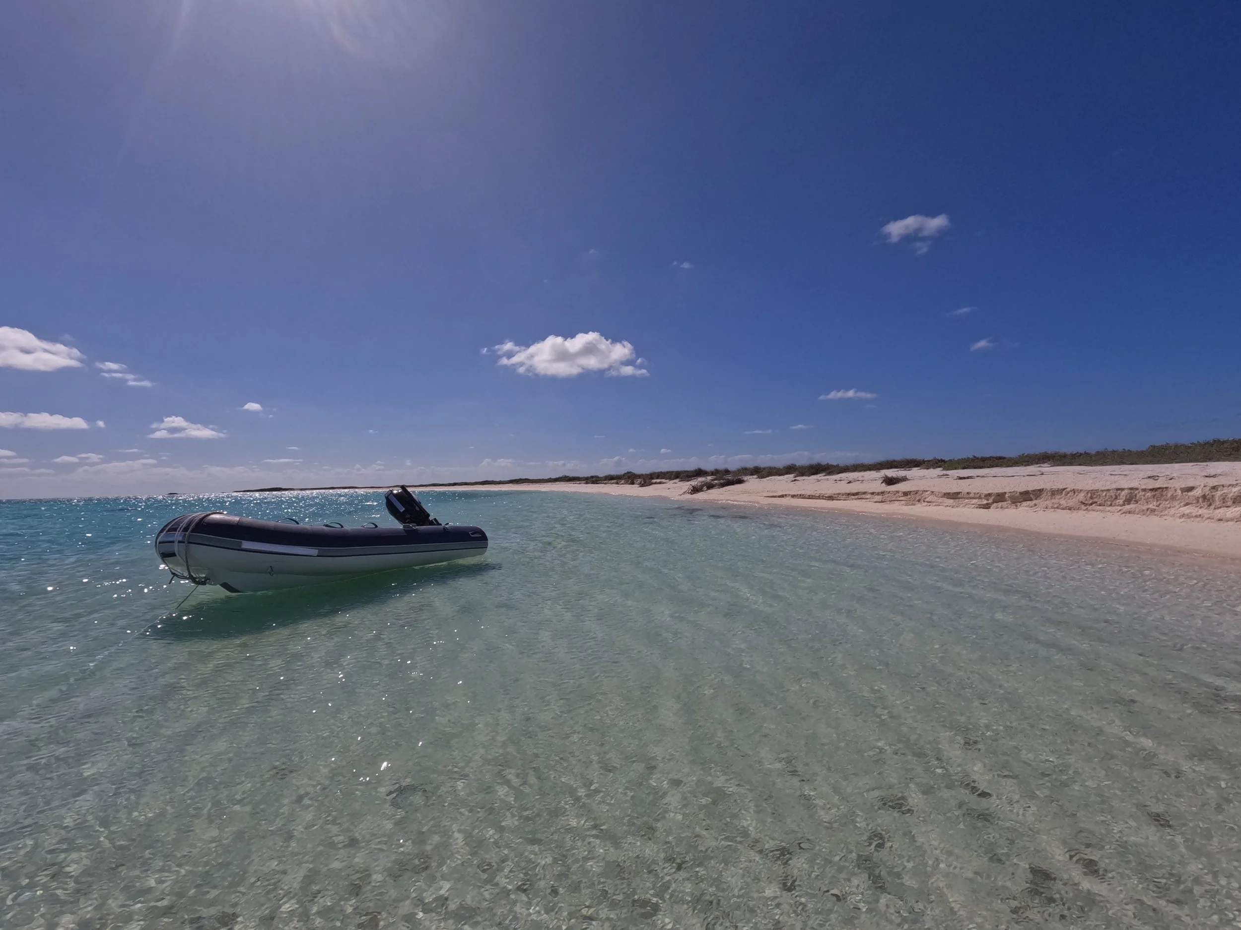
Once the weather had settled, we headed out of Middle Island and continued down to Wreck Point, which is located at the bottom of the Pelsaert Group. Interesting passage to get there - made much easier now with some navigation markers, and in typical Abrolhos style, it is 30 metres deep in the channel and only twenty metres to our beam, it is less than 1 metre deep! Hard to describe how beautiful it is down there… a ring of coral reef that is pounded constantly by surf that protects a coral filled area that covers a couple of square miles. This coral then fades into a sand bottom at about 4 metres deep that provides a large anchorage, but drops suddenly to 20 metres in depth within the middle of the lagoon. The description does not really do it justice and it’s difficult to get photos that demonstrate the full perspective (yes, Pete, we really do need to purchase a drone). Hopefully the photos we do have will give you some idea.


We had a couple of days exploring the Island. Plenty of diving with our diet switching up to 100% fish, with some squid thrown in for good measure. No crayfish… but we were confident they would come. Island exploration was fun with the old Guano Jetty and works to check out, plus the amazing eastern side of the island which is comprised completely of coral washed up on the shore - but metres and metres high.


We had a rendevous at Rat Island International airport to get to, so we departed on the Sunday to sail the 10 miles across the Zeewijk Channel to the Easter Group. The’ Zeewijk’ being another Dutch vessel that unwittingly ‘found’ the Abrolhos Islands.