
Montebello Magic!
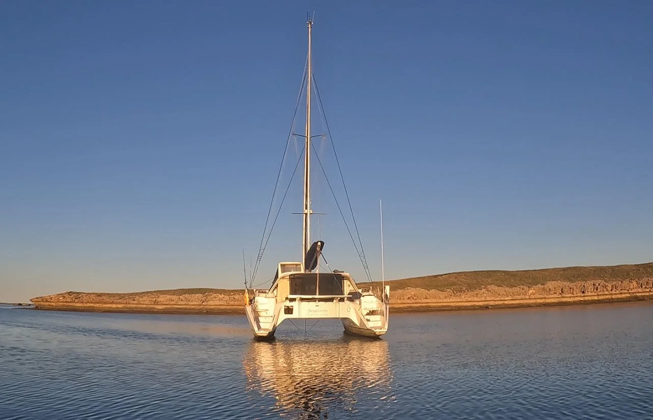
With much anticipation and excitement, we were finally steaming into the Montebello Islands. This had long been on Pete’s bucket list as a place to visit, both for the history and the marine life. Getting our first glimpse of the islands revealed some elevation and already we could see the remnants of an old building up on the peak at the south end of Hermite Island.

The Montebello Island chain is an archipelago of about 174 small islands located 120km off the coast. These islands achieved international notoriety in 1952 when the British, in an operation code named Hurricane, detonated an atomic weapon in a ship anchored off one of the major Islands - Trimouille Island. Two further atomic tests were carried out in May and June of 1956 on Alpha and Trimouille Islands.
Test 1 exploded inside the hull of the HMS Plym anchored in 40 feet of water, 400 yards offshore. The explosion occurred 2.7 m below the water line, leaving a saucer-shaped crater on the seabed, 20 feet deep and 1,000 feet across. The bomb was placed inside a ship because they were worried that a bomb might be snuck into harbours via a boat and wanted to know what that would look like post-explosion.
Tests 2 and 3 were the most powerful detonated in Australia. The final test was, in fact, a staggering six times bigger than the Hiroshima bomb. You can learn more about how the British and our Australian Government screwed us over here:
https://slwa.wa.gov.au/stories/slwa-abc-radio/montebello-islands-nuclear-testing
Interestingly, the Royal Navy named many of islands of the Montebello group when they were over here surveying for suitable sites to conduct the atomic testing. Several islands are named after European plants, points after British Prime Ministers, bays after drinks and channels after physicists.
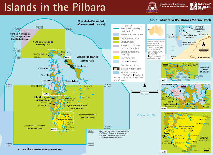
A lot of the waters in and around the Montebello’s are unsurveyed, so there is always some questions in your mind as to what to look out for as you’re traversing through. We had been grateful to receive a lot of tips and info from some of our cruising mates. Ted and Tina from ‘On the Double’ had been gracious enough to lend us a chart on which they had collated a whole bunch of information over the years, including tracks of where they had taken their catamaran. Also included on the map was info regarding surf spots, where best to fish, dive and snorkel, as well as some interesting places to explore. Priceless!
We were now entering an area where tides really start to dictate your daily life. Some of the best advice was to always move on a mid to high rising tide – thus ensuring you have enough water, but also with the premise that the rising tide will, hopefully, float you off if you get stuck!
Surprising to us (always different when you’re looking at a place on a 2D map), was the fact that the Montebello’s sit within a fairly small geographical area – about 10nm from north to south and probably a bit less east to west. So, the other great bit of advice we received was to use your dinghy to scope out where you want to go the day before and then use the right tides the next day to get there safely. All of this worked a treat as you will see from the examples below.
Coming in on the channel from the west, we were soon heading up the west side of Hermite towards an entry point, near Brooke Island. The west side of Hermite, which sits inside the outer reef and is protected by a giant lagoon, is all unsurveyed but we had been told that is was about 4 metres deep all the way up and this proved to be the case.
We were chasing the clock a little, as it was late in the afternoon and we were a little nervous about the entry point near Brooke Island, not really knowing how wide the passage was between the small islands to get inside to where we were planning to anchor. We wanted to go into a small cove adjacent to Turtle Lagoon, but we knew this wouldn’t be possible until high tide in the morning.
Our fears were soon allayed (as usual) with plenty of room and plenty of depth to pass between the small islands into a nice protected area just west of Turtle Lagoon. We were passing back information to Solitaire and Chasing Eden about depth and other things and soon all three boats were snugly anchored up in about 5 – 6 metres of water.


A good night’s sleep was had and with a high tide first thing in the morning, it was an early up-anchor to move the half mile across to the small lagoon which sat just outside of Turtle Lagoon. It was a shallow entry so we knew that once we went in and anchored, we would not be able to leave again until a high tide. All three boats made a slow and methodical entry close to the rocks on the south end, based on some advice we had been given. Thanks again, Ted. Soon, we were in and anchored in about 2.5 metres of water and with the tides being in the neaps phase (smaller tides) we were going to sit just off the bottom in low tide, but most importantly we were super protected from wind and swell.


It didn’t take long to get the boat organised and set up for an extended stay and, before long, we were in the dinghy and exploring. We headed to the beach, right in the corner near the entrance to Turtle Lagoon, which is only about 10 metres wide, and then walked up to a high point on the island to get our bearings.
Having been to the Abrolhos and a bunch of islands from Shark Bay north, we always enjoy taking in the composition of the island – rocks (often old reef), fauna, evidence of wildlife (poo and different tracks), birdlife and then evidence of human activity. We would soon learn that there is quite a bit of difference in the islands within the Montebello group, no doubt detonating a couple of hundred kilotons of atomic bombs had something to do with this!


As is the norm now, we settled into a routine of exploring, fishing, diving and socialising with our cruising mates. The channels just north of our anchorage were deep and the tidal streams strong, but there were magnificent coral bommies and ospreys patrolling the skies. Bob was getting a big workout as we made our way around all of the different nooks and crannies of this area, looking for dive spots and generally anything of interest.
The diving was great, but needed to be done in conjunction with the tides. We learnt that going at low tide in the channels gave us access to big coral bommies that sat on the edge of drop offs and were crowded with life, including decent sized and surprisingly docile coral trout which were so plentiful that you started looking for something else to eat!!
Always a lot of chat about mud crabs at the Montebello’s and there are extensive areas of mangrove. We had done a bit of crabbing back in the Hedland days and loved it, so we were keen to get amongst the mud and midgies. Some exploration through the back of Home Lagoon didn’t disappoint and soon it was chilli mud crabs for dinner. Not bad a bad outcome for our first day of foraging.


After about four days exploring, we were keen to head a bit further north to see what else the Monte’s had to offer. So, in anticipation, we took the dinghy up at low tide and plotted out a route that would take us up to the east side of Bluebell Island. We were able to mark out a few big coral bommies that were lurking up near the entrance to the bay, as well as a couple of sandbars. We use Navionics for our navigation. As well as having it on our chart plotter on the boat, we also have it loaded onto ipads and our mobile phones. When we go out exploring, we take a mobile phone with us so we can then add a marker for bommies or good dive sites etc. When we return to the boat, we sync all of our devices and view our updated markers etc – gotta love technology.
The next day, on a rising tide, we headed out of Turtle Lagoon, initially west as we picked our way through some small islands before running north up towards the entry channel between Alpha and Bluebell Island. Safely negotiating our way around the coral bommies we had marked, we slowly navigated into Bluebell Island taking up anchorage in a beautiful sandy cove. We knew we would be sitting on the bottom here at low tide and we were keen to see what this looked like, as it would be our first time. This is one of the advantages of having a catamaran with mini keels that can sit flat on the bottom, as long as you make sure the ground you’re sitting on is free of rocks or rubble that might cause an issue. Bluebell Island east is a really lovely protected anchorage that would give us closer access to explore the north western islands.


Again, we settled into a routine with more exploring, diving and fishing. Just around the corner were a series of deep channels and we spent quite a bit of time diving and fishing in these areas with great success. Big tropical lobster, coral trout, groper and spangled emperors were all in abundance – as well as the odd shark of course! Nicky was getting her head around the fact that you couldn’t catch some of the lobster with the snare – the snare just wasn’t big enough! You had to grab them by hand and wrestle them to the surface. It was hilarious watching her pull a monster out from under a big brain coral and then pretty much ride it to the surface like a horse, this thing bucking all the way to the boat.


We were coming into spring tides now, so we experienced our first dry-out with Singularity sitting flush on the bottom. A little nerve wracking to start with, but you soon get used to it and can sense at what point the boat comes free and starts to move again. We use a tide app called ‘Australian Tides’ which is perfect as it gives you precise information on timings and tide movements for any given location. This enable us to determine at what time we would be on the bottom and when we would be floating etc.
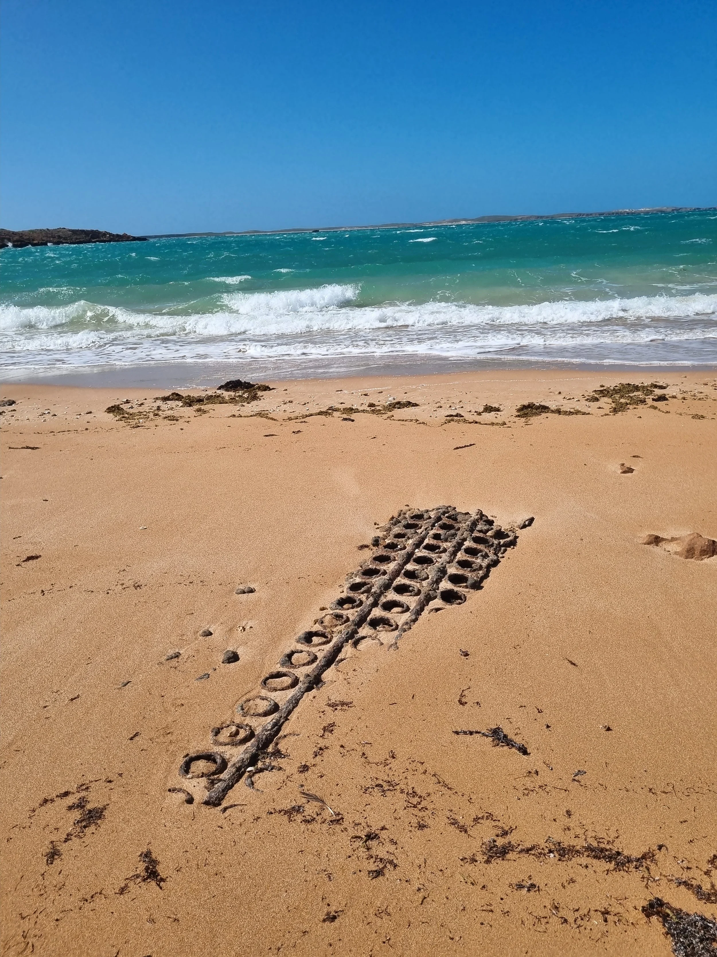
Part of our exploration in this part of the island group included a dinghy run across to Trimoulle Island, which is arguably the biggest feature of the Montebello group. It is a long, elevated island that runs from north to south, and this is the location where the British blew up the HMS Plym in 1952, as well as the land detonation in 1956. Beaches on the island are scattered with ‘Radiation Risk Area’ signs that advise potential visitors to limit their visit to 1 hour per day. Taking note of this, we walked to the land site and checked it out. Although the bomb on the island was detonated almost 70 years prior, the impact it had on the landscape was still obvious. As for the impact on the native flora and fauna, I guess we’ll never know. As you look out at the pristine, crystal clear waters, it’s hard to believe the testing was allowed to go ahead in a place of such isolated beauty. I guess times were different back then.


After our little history excursion, we ended up taking Bob down the entire length of the island, stopping to check out a few lagoons. We went south to Cocoa Beach, where we walked up to the top of the hill where a small lighthouse is located; the automated kind with a helipad adjacent to it, an amazing view south to Varanus and Barrow Islands, and across the whole of the Montebello group. It was a pretty sweet walk with some concentrated patches of Bluebell and Mulla Mulla plants guiding our path to the top. It was interesting to see that there is still quite a bit of bomb testing infrastructure left at this end of the island with old tanks and bits and pieces scattered around the place.


The only downfall for Bluebell Island east is that it was a little exposed to the eastly winds. With three days of screaming easterlies forecast, we decided to high-tail it across to Chianti Bay for some protection. We tucked into the corner at Chianti Bay, on the north side of Alpha Island and literally only about 1 mile from where we had just come from. Chianti and Chartreuse are the two main anchorages for the Montebello’s and there are always a few boats here, as well as a houseboat set up for charters on the western end. We tucked right up in the corner as far east as we could and just downwind of one of the atomic bomb blast sites. Perfect!!
This location had a sweet little beach, complete with radiation warning sign, that was a great spot to shelter from the wind, have a swim or leave the dinghy and stretch the legs. There were also a few squid hanging around (also sheltering from the wind), just off the rocks, and squid mistress Nicky was able to nab a few one afternoon. With everyone keen to get off their boats to avoid the ‘stir crazies,’ the beach became the social centre of the bay. We usually try to avoid busy anchorages, but this one was a blessing in disguise as we got to meet a whole bunch of new crew and share stories and experiences about our travels around the place. Definitely a highlight as we whiled away the time waiting for the wind to drop.


After patiently waiting for three days, the wind finally dropped. Ray and Jackie, on Solitaire, were keen to head back south, so we hatched a plan with Chasing Eden to do some further exploring and decided to head down to Brandy Bay, located at the bottom end of Hermite Island, and accessed via the Faraday and Stevenson Channels.
With a rising tide and favourable winds (i.e. not blowing 25knots), we followed Eden out of Chianti Bay and around the corner to Disraeli Point where we picked our way south down the Farady Channel. Navigation here is pretty much by eye – picking out the sandbars, following the channels and making adjustments as you go to chase the depths that you need to get safely through.
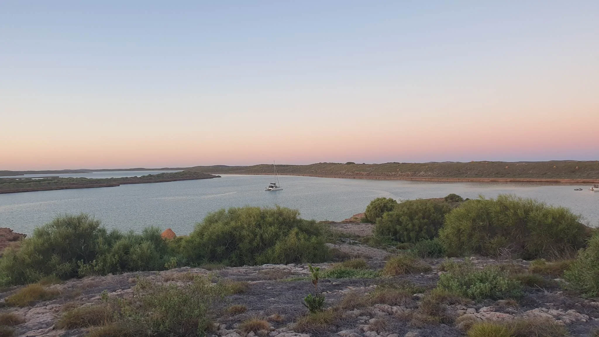
For a small section of the passage, you are briefly exposed to open water as you traverse between Faraday and Stephenson Channels. For the remainder of the passage, you are protected from any swell. It is really beautiful here and you hug the eastern side of the channel which winds its way down past sand and rock bars for just under 2nm before you go around a small point and head north west. There is a large sandbank here to be avoided and once clear of that we continued north in the channel until just inside the sanctuary zone where there was a spot for us to anchor. An amazing spot, beautiful and completely protected from all sides, with a small beach just inside us to our west.


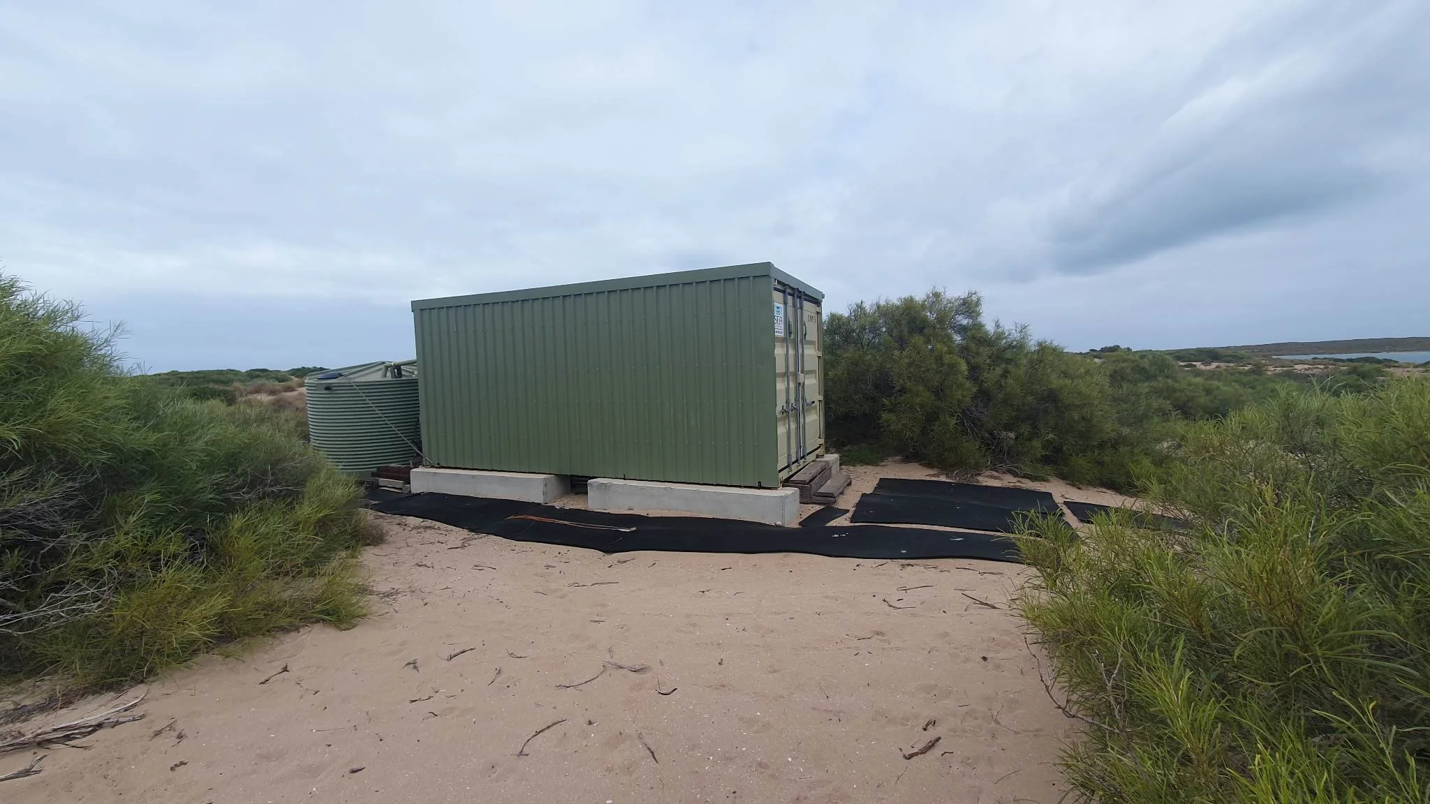
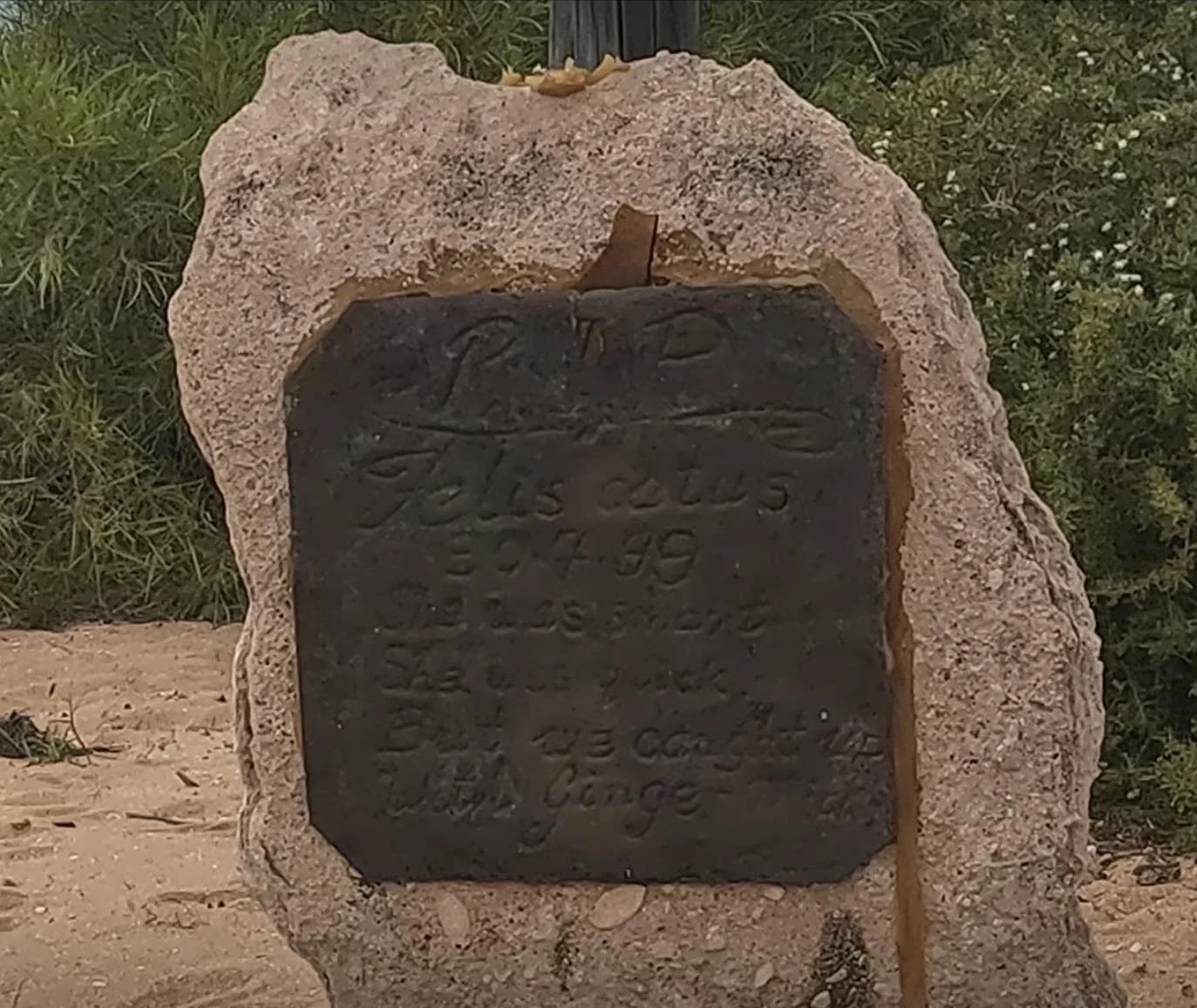
Same modus operandi here… exploring everyday by foot or by dinghy. DPIRD have a small set up in the corner of Brandy Bay where they used to have a shack, but now just a mooring and a sea container remain. There is, however, a small gravesite paying tribute to the last feral cat that was captured on the island during the eradication program back in the 90’s. It took 6 weeks to catch the last guy and the sentiments of those involved are captured on his gravestone. The eradication team were also responsible for naming many of the un-named islands after Australian Plants. This spot is also the location for the book Montebello by Robert Drewe, which we had both read, so it was good to put that into perspective.


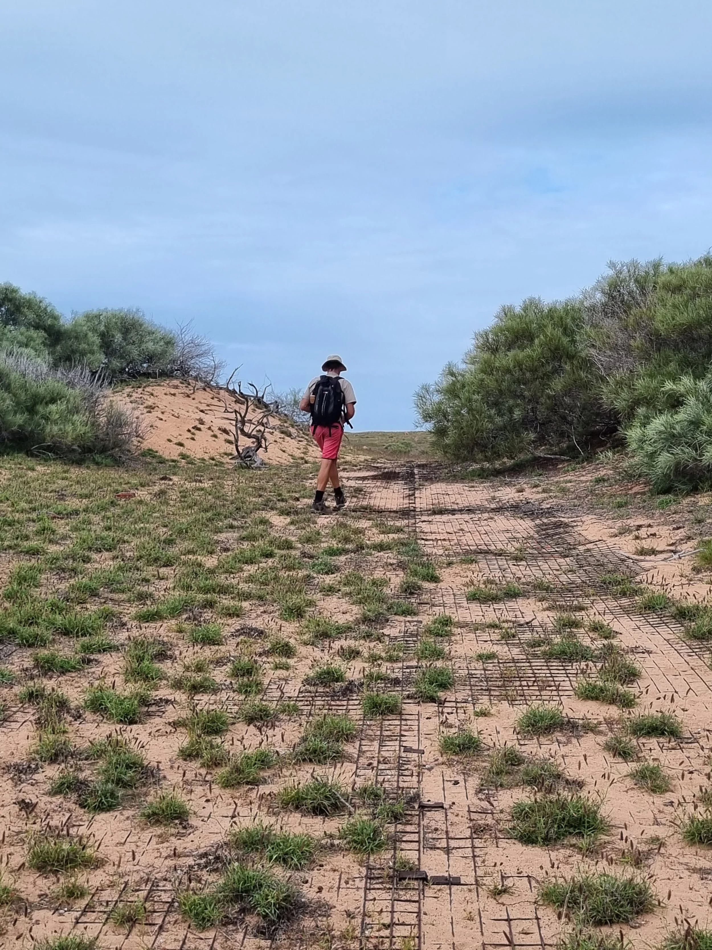
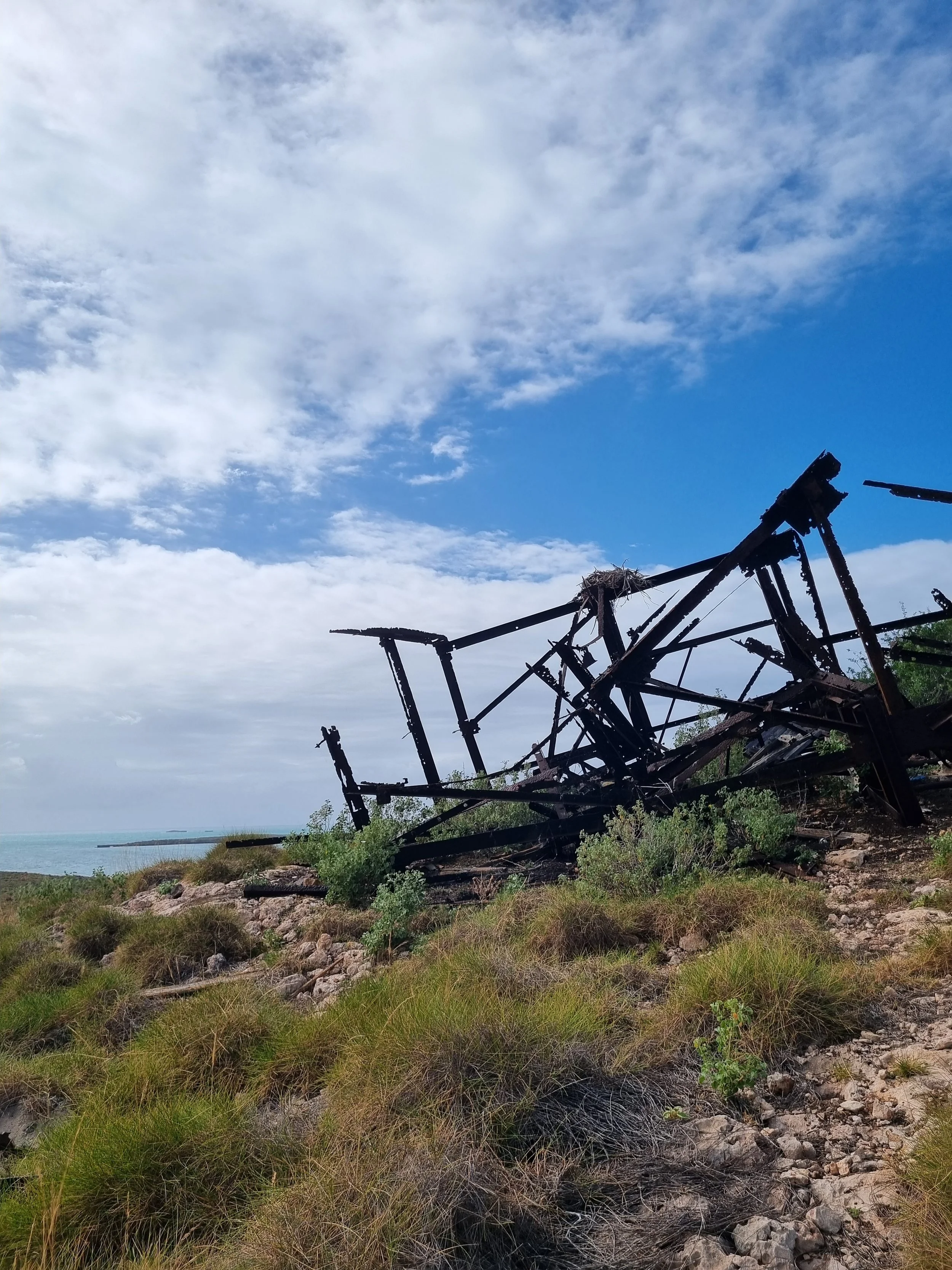
We walked down to the south end of the island where a large building structure remains rusting away up on the hill, overlooking the protected anchorage of Claret Bay. There is a lot of stuff still here from the bomb days, including wire mesh they used to make temporary roads, loads of old brown beer bottles, as well as rusting relics scattered throughout the bush. It was a decent walk up to the building, but we were rewarded with amazing views back across the island group, as well as to our south where the oil and gas industry is alive and well on Varanus and Barrow Islands.


Visiting these places makes it considerable easier to imagine how things were back when the bomb work was being carried out. Having read about the role of the poor old Aussie troops, a lot of whom were on national service, they really got the raw end of the deal. OHS wasn’t a thing back then for sure…
From our base at Brandy Bay, we had some great dives in Stephenson Channel but the highlight was heading down to Ah Chong Island. We cut through a tiny spot in the passage – only about 5 metres wide and out into the shallows of the western side. From there, we dinghyed past Foxglove, Buttercup and Ivy Islands onto the area around Ah Chong where we were rewarded with an amazing beach, diving, squidding and crystal-clear water. It was so good we did two days in a row in this spot with Beau, Casey and Hux off Chasing Eden.


We had been out on the water for nearly a month since leaving Exmouth and our fresh supplies were pretty much non-existent, so we started making a plan to head into Onslow for reprovisioning. Eden were in the same situation, so, after some weather consultation, we decided we would head to Onslow via Barrow and Thevenard Islands. To leave the Montebellos would involve us motoring all the way back out of the channels up to Disraeli Point, then going around it and down the channel towards Turtle Lagoon before exiting via the west side of Hermite. Essentially, we would travel 10nm to put ourselves in a position less than 1nm from where we anchored in Brandy Bay, but on the other side of the island. That is exactly what makes this place so interesting!
The wind gods were favourable and we had a nice sail across to Barrow Island. The plan was to anchor up at Flacourt Bay, which is a small, semi-protected anchorage on the west side. We made it by early afternoon which gave us some time to get to the beach and do some exploration. Interesting bit of coast here with big rocky headlands that provide a great view out across to the north, south and west. Really reminded us of our time in South Hedland. There’s something very distinct about the islands of the Pilbara. After some climbing and beach exploring, it was time for a swim and then back to Singularity.


We hosted Beau, Casey and Hux for a pizza night where we made the best of whatever we had left to knock up. Another beautiful night on the water with barely any wind and a carpet of stars overhead.
It was Tuesday, so that meant dinner night at Thevenard! We departed Barrow Island and had keen expectations of a stiff north easterly that would give us a great downwind run across the 50 or so miles to Thevenard. Naturally, the wind came and lasted for only about two hours before dropping completely. The ocean glassed off and it was iron sails the rest of the way to Thevenard. Of course, by the time we were ready to anchor, the wind had picked up to 15knots…what the hell??
We enjoyed dinner under the stars, a few games of ping pong (the competitiveness came out in all of us yet again :)) and then retired for the night, with only a short hop in the morning to take us across to Onslow.